By Arjen Zomer
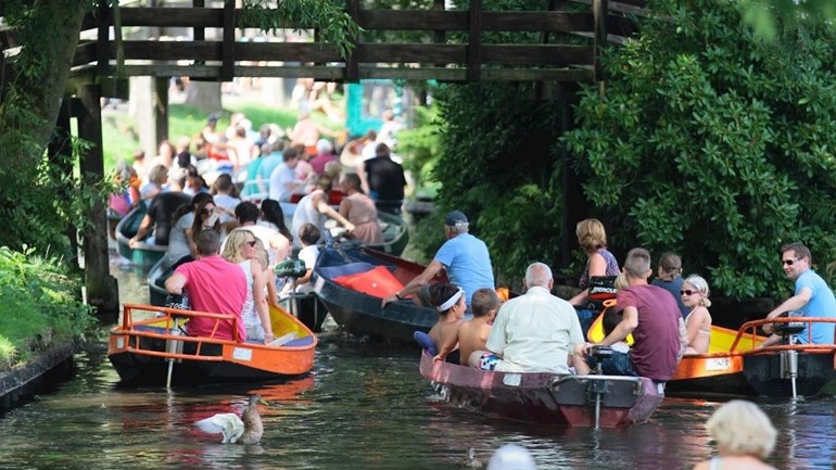
It is one of the most popular destinations for international tourists in the Netherlands: Giethoorn. Through marketing campaigns and different on social media, Giethoorn grew out to be the Venice of the North, for any foreign tourist a must to visit the Netherlands. Although it is not exactly clear how many tourists visit Giethoorn on a yearly base, the scale of the current tourism endangers the cultural landscape of Giethoorn. The landscape of Giethoorn tells the story of the cultivation of the fenland areas, which was done by digging for peat. This practice of digging peat still has its implications for the landscape, because it causes land subsidence nowadays. The combination of the ever expanding mass tourism and the pressure this gives to the Giethoorn landscape, made the municipality of Steenwijkerland invite students of TU Delft, Wageningen University and Vrije Universiteit Amsterdam (VU). This resulted in a three-day workshop in which the students had to make a landscape design that would solve (part of) the problems. This collaboration took place between students of Architecture (Delft), Landscape Architecture (Wageningen) and Heritage Studies (VU).
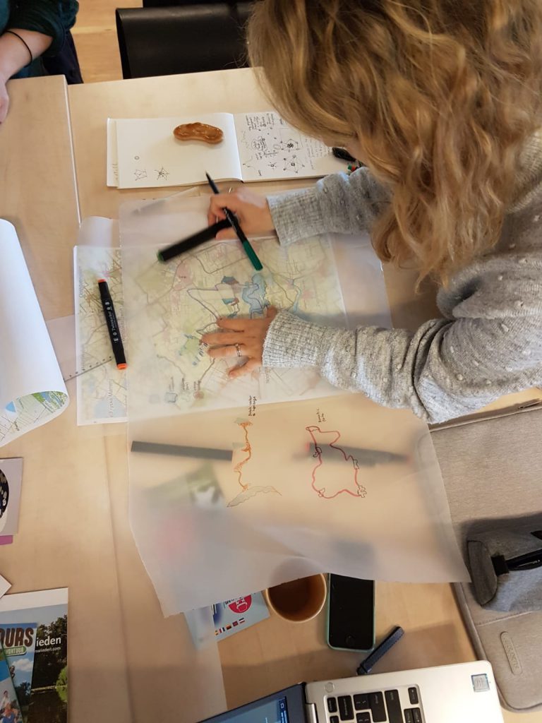
The students were divided into different teams, with a representation of all universities within each team. During the first day of the workshop, students had to start a brainstorm session and present preliminary ideas on how to solve the proposed problems. It was really interesting to see that most of the time, VU students started to problematize and to textualize this, whereas students of Wageningen and Delft felt more comfortable to start drawing on maps immediately, in order to identify problems afterwards. After these first steps in the process, a typical boat trip was organized, in which every team had the opportunity to be guided by a local expert. This personal guide was able to introduce the students to the landscape and gain some basic knowledge about it. The brainstorm session and the impressions of the boat trip was combined into a presentation per team at the end of the day to present some preliminary ideas. As a result of this first day, all teams were able to identify their specific task. Afterwards, the teams were pooled thematical background for the final presentations. The second day was merely a day to elaborate on the team’s ideas and to gain feedback by the teachers, to make sure that there would be a complete story to tell on the third day. This final presentation on the third day was held in front of an elderman, a local entrepreneur, a municipal landscape architect and an environmental director, also commissioned by the municipality.
All teams were able to give a problem statement, a cultural-historical background and the eventual design. The municipality was really surprised and grateful that the students had been willing to dive deep into the problems and to come with really concrete propositions. It was a really interesting experience for the students as well, because it gave insight in how their future role as heritage expert could be. During the workshop it became clear that in spatial planning processes it is vital to have a director, who is able to zoom out when needed and to take the cultural-historic value of the landscape into account as well. Most of the VU Heritage students had the same conclusion at the end of the workshop: they are needed in these spatial development processes, to provide it with a critical view on how actors within the same process look upon the landscape to plan.