by Asja Boon and Dominique van Oeijen, students Heritage Studies
The Hembrugterrein is a monumental and industrial terrain in Zaanstad, which was used as a military complex in the Netherlands until after the second World War. The terrain’s identity has always been ‘closed’ since it was not open for visitors. This changed however, since the complex opened its doors in 2014 for cultural and commercial companies. It resulted in many different recreational activities we came across.
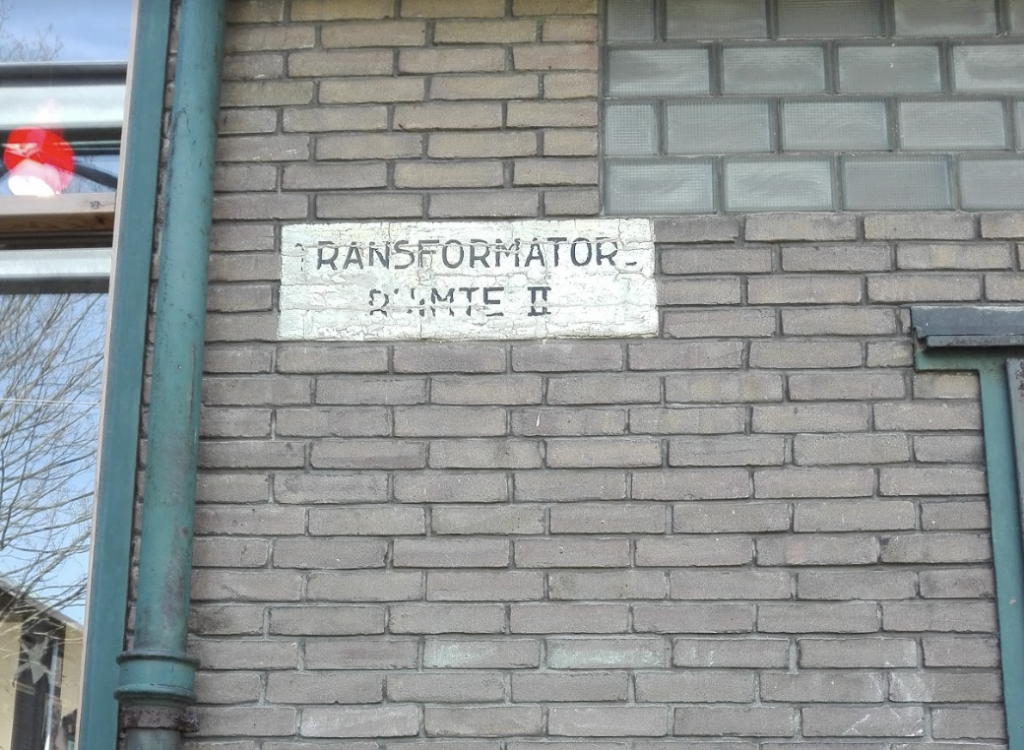
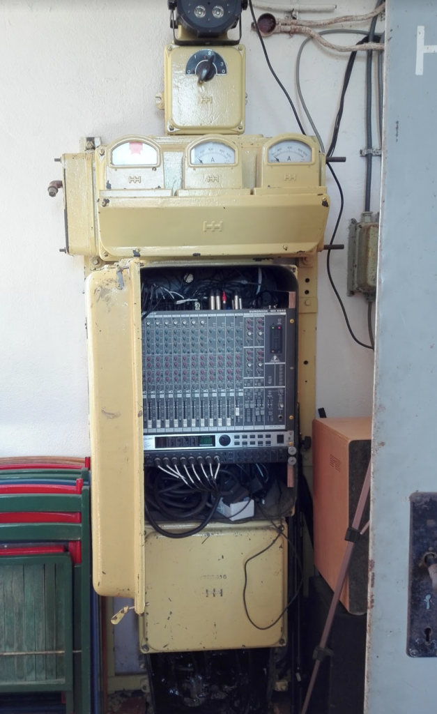
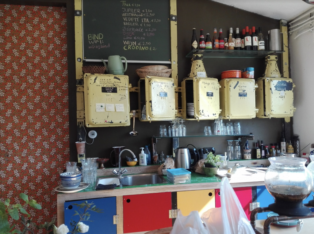
For example the café Bind. The café exists of one building only, a former ‘Transformator’ house. The interior of the building still shows its original function. They cleverly re-used certain elements for storage (fig. 1, 2 and 3), but also changed the house by building windows (which it barely had originally, the employee at the café told us).
Other examples of re-using the buildings of the complex are the furniture shop Flinders and the Yada Yada market. Flinders made optimal use of the ‘openness’ and high ceilings of a former factory. They divided the spaces by placing high plasterboards on which they secured the chairs to display. It is worth noting that the industrial style of the building suits the modern furniture they sell particularly well. It would be interesting to examine if it would work out just as well with classical furniture, for example.
The cultural sector is present as well: two museums appeared at the complex. The Hembrugmuseum and the Streets of the World Photo Museum. The Hembrugmuseum provides a necessary understanding and the history of the complex. Making this story available for people visiting the area, contributes to a better understanding of the complex, and helps to preserve the original identity. The Photomuseum has visibly re-used the building’s history. It used to be a warehouse, formerly owned by Sir De Doodt (which means ‘death’). Instead of linking the building to its former function, they nicknamed their building ‘the Death’ in reference to its former owner. For the design they chose to preserve the raw, industrial interior.
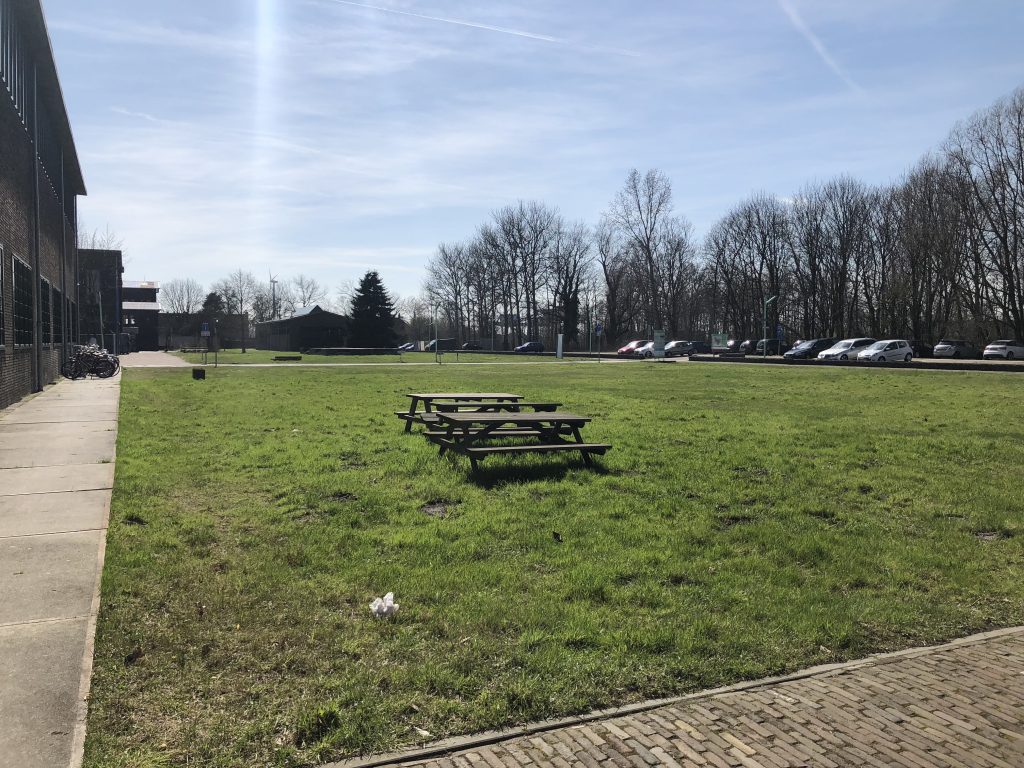
The spaces between the complexes are rather large. Several of them are used for leisure activities, covered with grass and picnic benches (fig. 4).
CHALLENGES
The redevelopment and re-use of the Hembrugterrein provides great potential, but we also noticed various challenges and problems.
The first issue encountered was the accessibility to the terrain. Reaching the area by car or bicycle is fine, but there is hardly any public transport. Only one bus connects the area, which travels once an hour. This results in a weak accessibility for various groups of people. The developers of the terrain and the municipality could be responsible for improving the accessibility of the site, as it is important to connect the Hembrugterrein to the rest of its region.
A second challenge is the responsibility for the current 35 monumental buildings. As the government sold its terrain to a project developer, it becomes an issue what will happen to these buildings in order to safeguard its monumental values. So far, many buildings have completely been re-used, apart from small changes made in the interiors. A solution could be hiring heritage specialists, who could appropriate the monuments in a new function to its full extent.
A third problem followed by the sale of the terrain, is safeguarding the low ‘horizon’ of the complex. All buildings are relatively ‘low’, and this ‘low skyline’ partly constructs the complex’s identity. With the plan to build more than 1000 dwellings, a challenge is to preserve this current low horizon which identifies the Hembrug terrain.
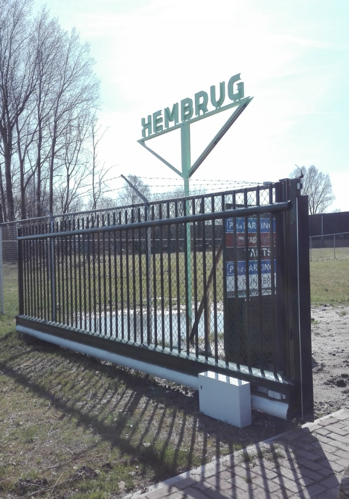
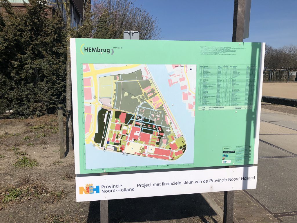
In general, the layout of the terrain could pose many challenges and problems. In 2014 the complex was not sold as a unified area, which shows. The many isolated buildings cover different functions and are scattered throughout the area without a very definable uniformity. It seems the Hembrugterrein now tries to create some recognizable uniformity by placing several elements of a certain ‘corporate identity’ (‘huisstijl’) (fig. 5 and 6). Those are present at the entrances of the terrain and on several maps of the terrain, to try and create a sense of ‘harmony’. This corporate identity is a first good attempt but needs more development as the visitor could still feel relatively lost. The maps on the terrain are unclear and hard to read (fig. 7). In order for the visitor to have a better understanding of the terrain, the future developers and designers could try to make the history of the place more ‘readable’ by ways of designing the open spaces or by intervening in existing buildings.
OPEN VS CLOSED
As we mentioned the issue of isolated buildings and spaces before, we especially feel like the area is a not a unified complex. Some open spaces are well designed though, like café Bind. They created a meadow-like landscape: green grass, benches to sit on and spaces like a ‘hut’ in which you can drink your coffee and read a book. But most open spaces lack a function, and do not connect the several buildings. We would suggest aiming at connecting the isolated monuments through the open spaces, by creating clear paths and ‘guiding’ lines for the visitors. Especially remarkable is the large parking lot at the entrance. It was empty now, and gave the site an ‘abandoned’ look, however during large events we can imagine it fulfils an important function. An option for the parking lot would be to build it underground, which generates a new open space, available for festivities or a park, for example. We can also imagine outdoor gym material being build, which can be used by bootcamp activities, to enhance also sports and educational functions in the complex. A final idea would be to create a community center. This may contribute to collaboration between companies, citizens and the municipality.